 Lukla is a town situated in the Khumbu, Nepal. It’s at at 2,860 meters (9,380 ft)
and it has a small airport. Lukla means: place with many goats and sheep, nowadays is unlikely to see many movement around.
There is a regular flight between Lukla and Kathmandu, if the weather permits, the runway is only accessible to helicopters or short takeoff and land aircrafts, such as Twin Otters, particulary the De Havilland Canada DHC-6 is the more frequent.
As I said the runway is too short it has 1476 ft. long, also there are only 4 parking positions so convined to the fact that the airport is too busy, this things make it worse.
Apart from that, is very very nice airport, and is a very wonderful experience to go there, an excellent landscape makes you feel to be in other world.
But not all the people have the opportunity of travel to Lukla, so imagine to have Lukla on your computer, well Aerosoft make it possible.
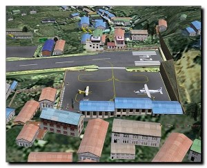
The scenery of Lukla for Flight Simulator 2004 has an excellent detail level, if you compare the real life airport with the Lukla Scenery of Aerosoft, you wouldn’t be able to find any difference, is really very well done.
The first thing I want to highlight is that is simulated the undulation of the runway, a thing that the Flight Simulator doesn’t allow originally but the excellent developers of Aerosoft manage to do it.
Lukla Scenery also includes other smaller airports that are located in this city in Nepal which I will specify then, as you can see in the pictures.
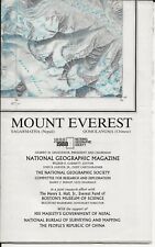
Other thing very important to stand out is the Mount Everest that isn’t only photoreal, is very high detailed physically too and near the mountain is made like an accident, where you can go and see an Helicopter crashed, people asking for help and this is a thing that make the scenery more interesting and gives you a real touch.
Something that shows you the high detail level of this add-on are the waterfalls reproduced all around the place, that in the real life you will see.
In addition are included two additional strips: Phaplu and Syngboche that were closed of protests of the locals because they are situated at 12286ft.
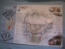
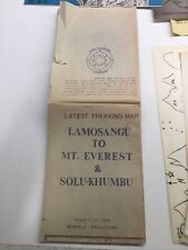
Is important to point out that every single house that you see in this scenery is based on an official Nepalese maps, a very fine job of the Aerosoft’s team.
To summarize I think that if you want to know Lukla without going to there you have to buy this excellent add-on, also would be a great experience, because you will have to fight with the things that happens at that altitude and you will gain knowledge of flying in altitude.
Finally if you have any hesitation check this features and convince yourself:
Lukla – Airport at the top of the world features;
o Lukla airfield with its spectacular very short, very sloping runway, at 9000 plus altitude.
o High definition mesh for the entire area.
o Based on commercially available satellite image (expensive stuff, believe us).
o Lukla village in great detail.
o Nearly all villages in the area at their exact location with every single house based on official Nepalese maps. Nepalese style and not standard autogen of course.
o High resolution mesh terrain and texture resolution of Mt. Everest Mountain provided by no other commercial add-on
o Mount Everest base camp (helicopter destination) and other camps higher on the mountain.
o Two additional strips nearby; Phaplu and Syngboche (closed because of protests of the locals, but even higher than Lukla at 12286ft!)
o Some of the villages have typical Nepalese stupas (shrines) and the famous Tengboche Monastery at the Everest trekking route is included.
o Not a single road in the scenery!
o Two missions dangerous enough to get you killed.
o Manually placed landclass, plus all rivers and lakes.
o Extensive manual, with chapters on high altitude operations (available in French very soon as well).
Requirements:.
Simulator: FS2004, updated to version 9.1 only!
Download size : 32 Mb
Install size: 75 Mb
Hardware Specifications: 2Gh CPU, 512 Mb internal memory, 128Mb graphic memory
Advised: 2.5Gh CPU, 1 Gb internal memory, 256Mb Graphic memory


